

OFATV Recreational Trail Guide (QUADON)
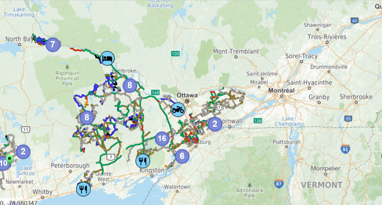
The Ontario Federation of All Terrain Vehicle Clubs maintains an interactive mapping application page, where you can find ATV trails and services close to the trails.
Access their site here
How to navigate the map
To navigate the map, you can:
- drag it around using one finger
- double-tap at any location to zoom in
- pinch using two fingers to zoom in or out
- use the geolocate tool at the bottom-right of the map to recenter the map to your current GPS location
- use the search tool above of the map to search for an address and recenter the map on its location
Legend
From the menu, select the Legend item. You will see the legend items of the trail network and trail status.
The trail status can be turned on or off using the checkbox next to it.
At the top of the legend section, you will see a group of buttons representing different map backgrounds. To switch map background, simply touch the one you want.
Trails that are shown on the map can be tapped to obtain more information.
Services
From the menu, select the Services item. You will see a list of services close to the trails that can be turned on/off on the map.
Services that are shown on the map can be tapped to obtain more information.
Plan your trip
At the top-right corner of the map, the “Plan your trip” tool allows you to create your own trip to one or multiple destinations along the trail network.
To enable the tool, touch the button. A list of destinations will be shown on top of the map. While enabled, you can:
- Add Start, End and Intermediate Destinations:
- tap anywhere on the map to add a destination to the trip
- tap on a service or trail on the map, then on the in the section blow the map to add a destination from there
- use the search tool on top of the map, then touch the icon to add a destination using the returned location
- use the geolocate tool on the bottom-right of the map to add a destination from your current GPS location
- Modify the selected Destinations:
- drag a destination marker using a finger on the map to change its location
- tap a destination marker on the map to remove it
- touch the X next to a destination from the list to remove it
- drag a destination using your finger up and down in the list using the icon to change its order
- touch the reset button to remove all destinations
- Save and Load Trips:
- touch the save button to save the trip in your browser
- touch the load button to restore a previously saved trip from your browser
As soon as there are at least 2 destinations, a trip is calculated and shown on the map.
The “Steps” button now being shown can be touched to open a page that contains:
- step-by-step instructions that can be touched to recenter the map to the location of each step
- the total distance of the trip
When a trip is shown on the map, blue circles with a white + are shown at the middle of each line between each destination. These blue circles can be dragged around using the finger to insert a new destination from this location. The trip will be automatically updated as you drag.
To close the tool, touch the top-left arrow . If you had an active trip, don’t worry: it will remain visible on the map.
Share a map
You can use the share tool located at the bottom-right corner of the map to obtain a url with the current state of the map that can be copied and shared with anyone you want.
If a trip is currently active in the map, it is going to be shared as well.